Benefits of Aerial Imagery: A Strategic Tool for Ecosystem Analysis and Communication
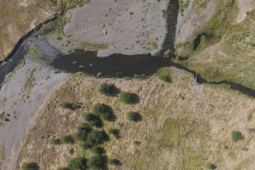
Aerial shot of Salmon Habitat Grande Ronde River
In the realm of conservation, non-profit organizations, and scientific research, aerial imagery has emerged as an indispensable tool. This powerful technology provides a bird's-eye perspective, enabling a comprehensive understanding of vast landscapes, remote areas, and intricate ecosystems. By harnessing the capabilities of aerial imagery, conservationists, researchers, and non-profit organizations can make informed decisions, plan effective work strategies, and improve their communication and outreach efforts.
Targeted Applications of Aerial Imagery in Environmental Conservation
Habitat Assessment:
Aerial imagery provides an unparalleled overview of various ecosystems, including forests, wetlands, and grasslands.
It aids in accurately mapping and categorizing these habitats, offering crucial insights for biodiversity conservation and land management planning.
Monitoring Vegetation and Landscape Changes:
This technology is exceptionally effective in tracking changes in vegetation cover and landscape over time.
It enables conservationists to detect early signs of environmental stress, such as deforestation, habitat fragmentation, or invasive species encroachment, facilitating timely intervention.
Enhancing Stakeholder Communication:
Aerial imagery serves as a powerful tool for storytelling and narrative building.
It allows organizations to create compelling visual content that can clearly articulate the impacts of their conservation efforts, engaging stakeholders more effectively.
Developing Robust Communication Narratives:
By showcasing before-and-after imagery and time-lapse videos of conservation projects, organizations can provide tangible evidence of their work and achievements.
This visual documentation not only supports funding and policy advocacy efforts but also helps in educating the public and garnering community support.
Advantages of Aerial Imagery in Conservation
Comprehensive Data Collection: Aerial imagery allows for a more thorough and expansive survey of large or inaccessible areas, yielding detailed environmental data.
Cost-Effective and Safe: It reduces the need for extensive fieldwork, cutting down costs and minimizing risks associated with physically challenging environments.
Dynamic Data Analysis: The high-resolution imagery facilitates a more dynamic analysis of environmental changes, leading to informed decision-making and proactive conservation strategies.
Partnering with ForeSight Drone Services
ForeSight Drone Services is at the forefront of providing specialized aerial imaging solutions tailored to the needs of conservation organizations. Our expertise in capturing and interpreting aerial data is instrumental in habitat assessment, monitoring ecological changes, and crafting influential narratives for effective stakeholder communication.

