
Aerial Photo-Point Monitoring
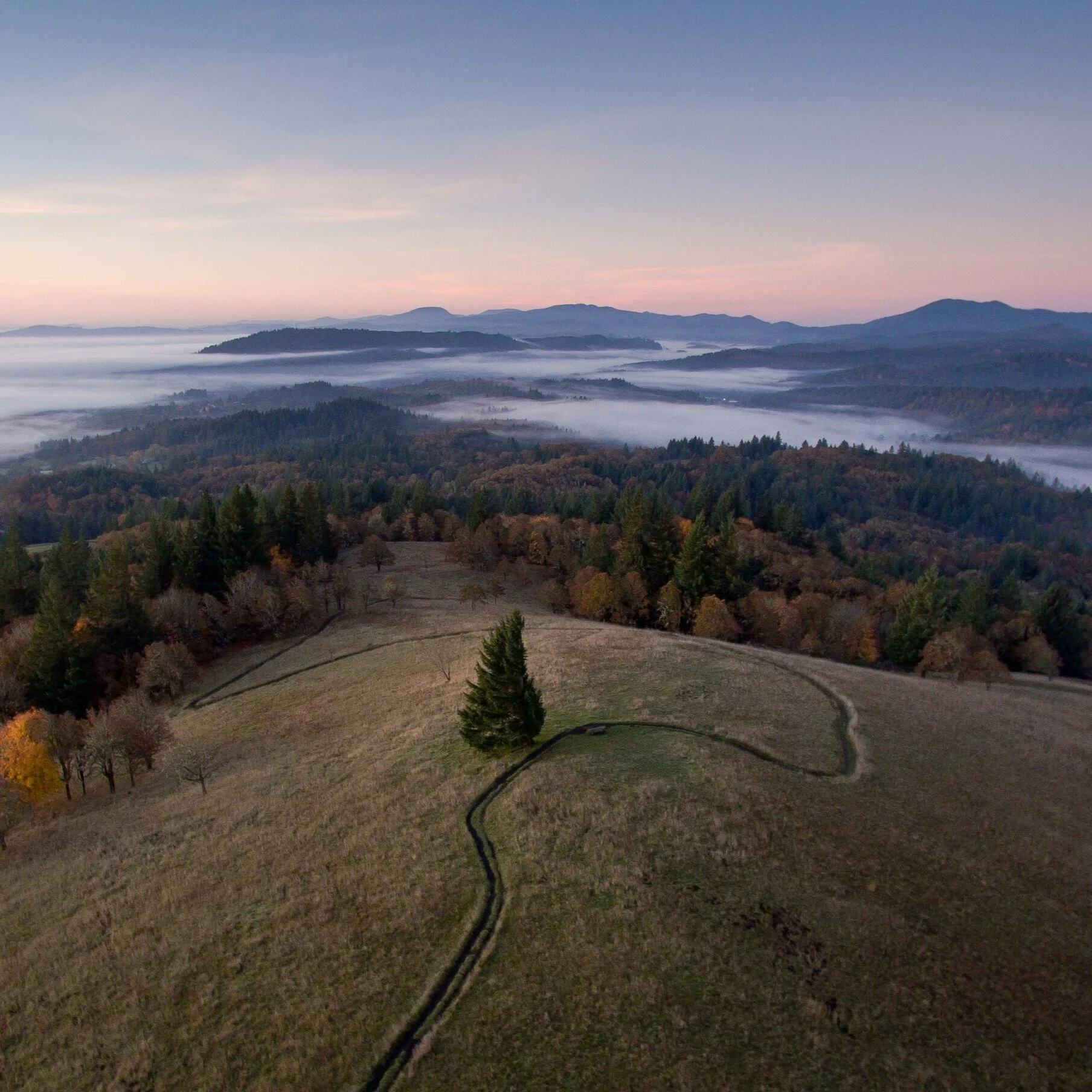
Our Aerial Photo-Point monitoring service enables qualitative change detection on a landscape scale. Our custom workflow enables autonomous flight to re-compose the same photos over and over so your impact can be seen and speak for itself.
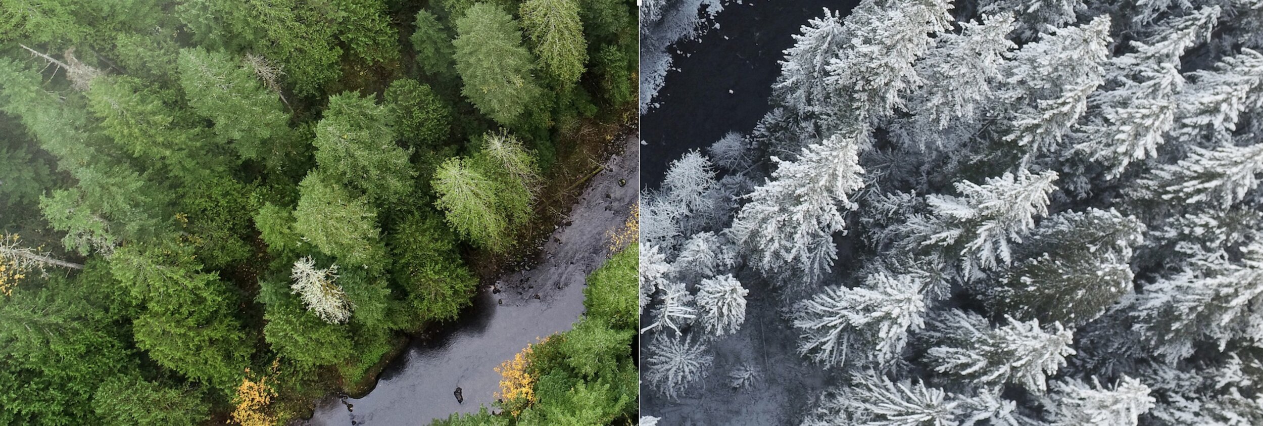
Visually show the impact of your work with clear before and afters
➜ Highlight landscape scale changes for followers and funders.
➜ Save time and money over traditional photo-point monitoring.
➜ Chronicle your site and create engaging visuals.

Generate interactive visualizations to show land changes over time
➜ Interactive side-by-side sliders engage your web audience
➜ Overlay text and visuals to communicate key points
Deliverables
✔︎ High-res jpg or RAW image file sets
✔ Interactive sliders of the best shots for embedding on your organization’s website.
✔ With 4 or more repeated visits, time-lapse video clips illustrate changes over time.
What Our Partners Say
Our Work Process
1
You choose the subject matter of interest and we photograph the best angles on the first visit.
2
Then those same shots are re-taken at a later visit and can be repeated as many times as needed.
3
Our custom software turns our drone into a virtual tripod in the sky, providing precise image re-composition
4
Sliders and time-lapse derivatives illustrate the impacts and changes over time. Let your impact speak for itself.
Applications
See our comprehensive list of applications for aerial imagery.
-
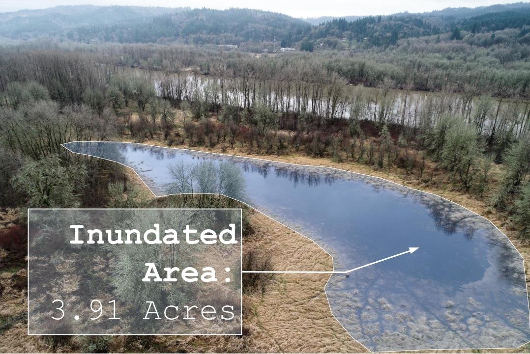
Let your work speak for itself. Precise before and after aerial shots intuitively show changes at a landscape scale.
-
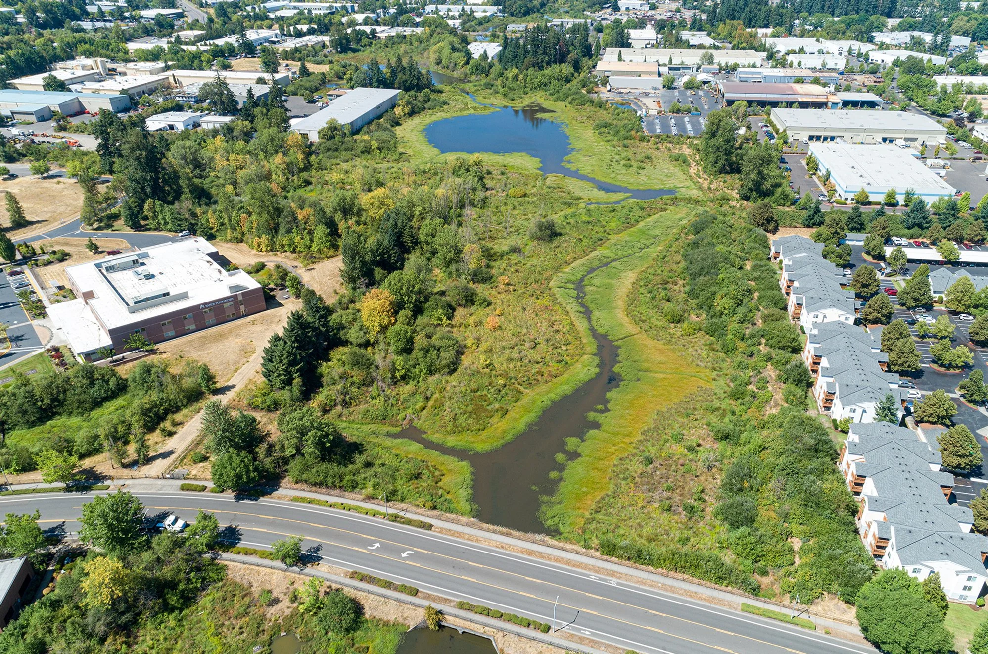
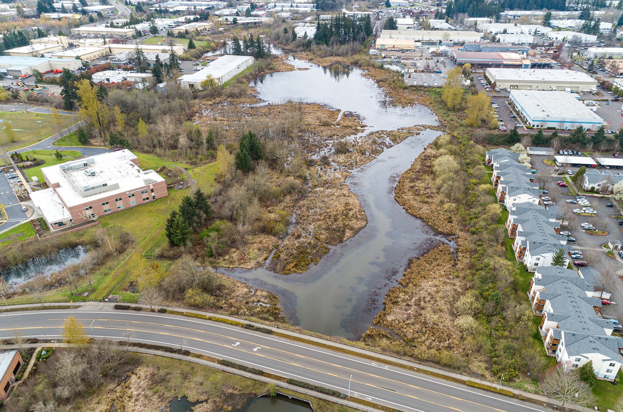
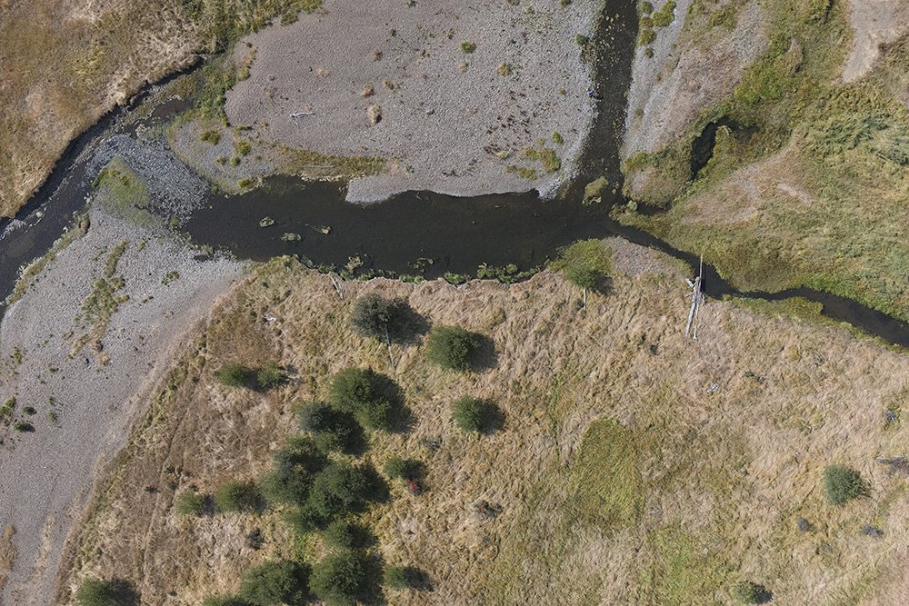
Seeing changes clearly can help spark deeper conversations and better stewardship. Repeated photo-points clearly capture phenological and man-made changes, whether it's leaf on vs. leaf off, or low water vs. high water, or before and after a stage 0 river restoration, aerial photo-points enable qualitative analysis on a landscape scale.
-
A picture is worth a thousand words. Wow your grantors with landscape-scale before and after shots that leave no room for interpretation.
-
Whether it's partners, grantors, constituents, or the general public, do them a favor: show them, clearly, the impacts of your effort.
Restoration Monitoring with Aerial Photo Points and Mapping
FEATURED CASE STUDY
FAQs
-
Aerial photo-point monitoring is a method of tracking changes in vegetation and ecosystem health by taking repeat photographs of an area over time from an elevated viewpoint. It’s like traditional photo-point monitoring, but with an aerial perspective, and on a landscape scale.
Aerial photo-points can be used to qualitatively monitor the effectiveness of restoration projects, track the spread of invasive species, document changes in land use, and provide a visual record of change that can be used to track progress, make informed decisions, and communicate results to stakeholders.
-
Provides a visual record of change: Aerial photographs provide a clear and concise way to track changes in vegetation and ecosystem health over time.
Can be used to monitor large areas: Aerial photo-point monitoring can be used to monitor large areas, making it a cost-effective way to track changes across a landscape.
Can be used to monitor a variety of changes: Aerial photo-point monitoring can be used to track a variety of changes, including changes in vegetation cover, species composition, and land use.
Communication and education: The clear before and after photos of the changes to your site leave an undeniable impression on your partners and audience.
-
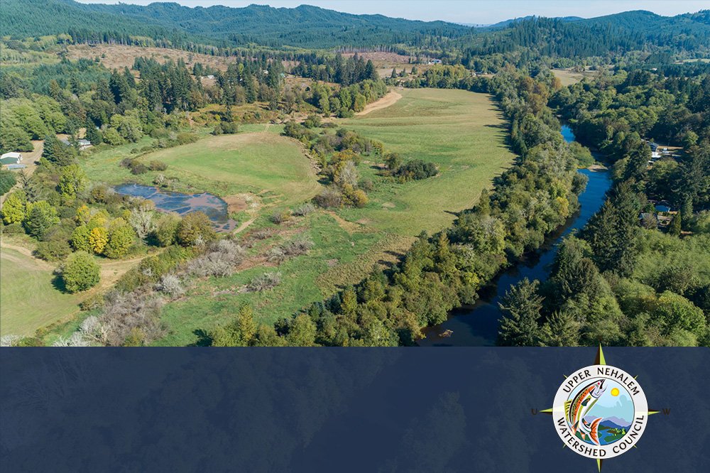
Monitoring the effectiveness of restoration projects: Aerial photo-point monitoring can be used to track the progress of restoration projects, such as river or wetland reforestation, invasive species removal, native plantings, ecological uplift due to beaver introduction, stage 0 progression tracking, and many more.
Tracking the spread of invasive species: Aerial photo-point monitoring can be used to track the spread of invasive species, such as cheatgrass, reed-canary grass, or armenian blackberry.
Documenting changes in land use: Aerial photo-point monitoring can be used to document changes in land use, such as the conversion of forests to agriculture or the development of new housing subdivisions.
-
By providing detailed, high-resolution images captured from aerial viewpoints, these services enable the detection and analysis of environmental changes, land use alterations, and ecosystem dynamics on a broad scale.
-
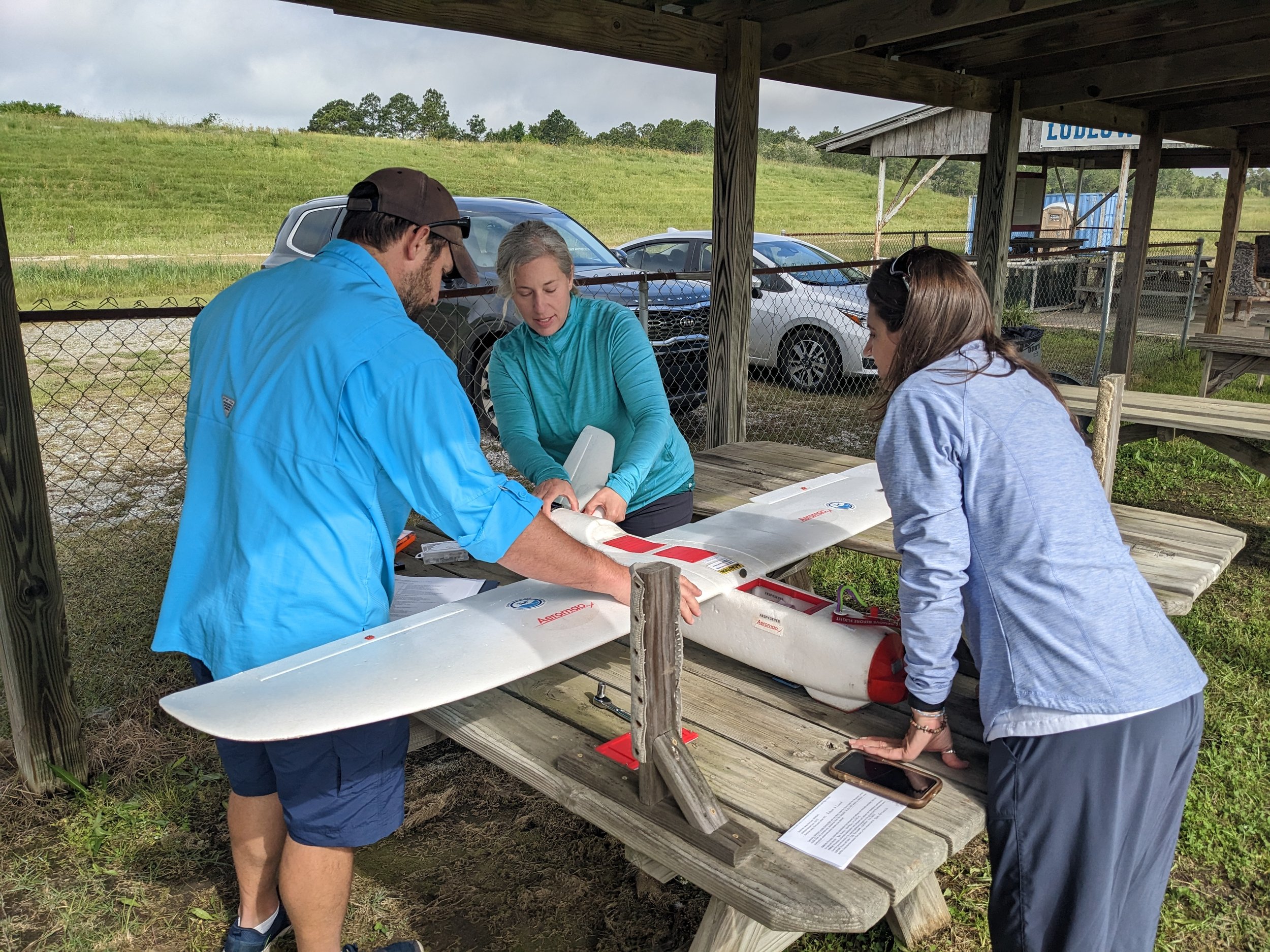
Our services typically utilize advanced drones or aircraft equipped with high-resolution cameras along with onboard sensors for positioning and image composition. Each aerial photo-point is described by 5 variables: latitude, longitude, altitude, heading, and camera tilt angle. The drone contains on-board sensors to collect these 5 values: a GPS receiver, a barometric altimeter, digital compass, and a gimbal position sensor for the camera angle. ForeSight has developed custom software to recreate any aerial image in these 5 variables.
-
Yes, likely! If the original photos contain the metadata from the drone used to capture the images, we can likely collect the information we need to re-take photos from the same perspective and capture the same composition.
-
The frequency depends on the project needs. It can range from bi-annual to annually, or even more frequently for dynamic landscapes, for example quarterly to track seasonal changes, or at key project milestones.
-
Because of the oblique angle used for most aerial photo-point photos, these images aren’t appropriate for quantitative measurements or tracking. The real power of the photo-point is for your audience to see intuitively, and at-a-glance, the quality of the changes. If you want to make measurements and track changes quantitatively, please check out our Aerial Mapping service.
-
We provide comprehensive support, including precise image-pair alignment, custom slider or animation creation, and follow-up consultations to advice on integration and best delivery methods.
-
Absolutely. We always tailor our services to meet the specific requirements of your project. We recognize that there’s no one-size fits all, and our value is in customer satisfaction, reciprocity, and building a strong community around conservation.
Other Services
-
![]()
360° Virtual Tours
Give your audience an experience. Engage the next generation of followers
-
![]()
Aerial Mapping
Monitor better with a high-res photo map of your site. Chronicle your site and measure changes over time.
-
![]()
3D Story Mapping
Wow funders with guided virtual tours of your site in 3D. Engage the next generation of supporters.
-
![]()
Aerial Topo Mapping
Analyze your site in three dimensions for better stewardship Bring your site to supporters with a digital 3D Story Map
-
![]()
Aerial Photo & Video
Tell the story of your work with rich and eye-catching visuals from above
-
![]()
GIS Analysis
Turn raw aerial data into actionable insights. Answer research questions and report to stakeholders.
-
![]()
Drone Training
Build drone capacity in-house. We develop custom curricula tailored to your organization and team needs.


Interested in aerial photo-point monitoring?
Stay informed with the latest updates! Learn how Foresight Drones is collaborating with local organizations to positively influence the Pacific Northwest ecology.