
Featured Project
Restoration Monitoring of Off-channel Habitat Improvement on the Nehalem River
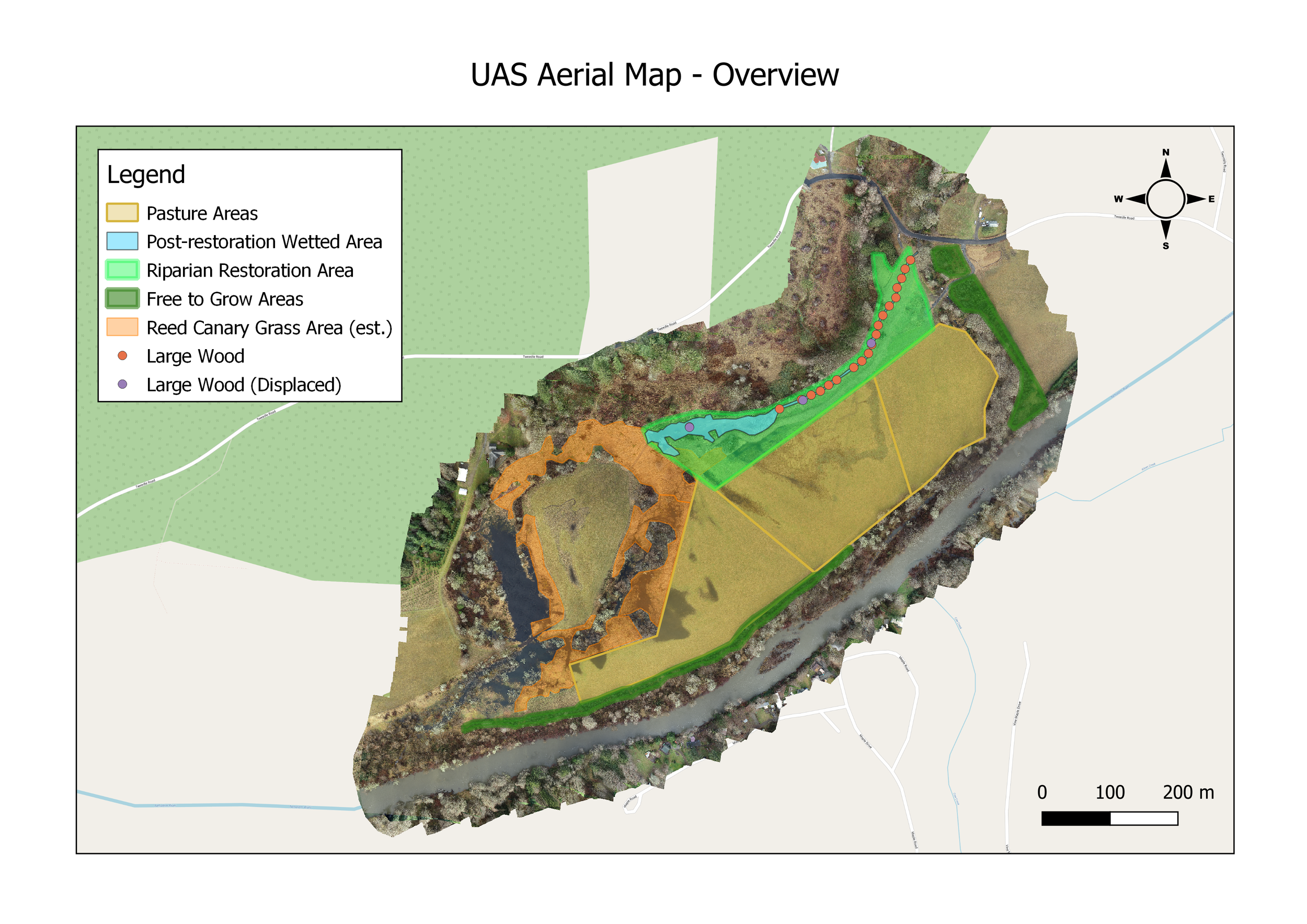
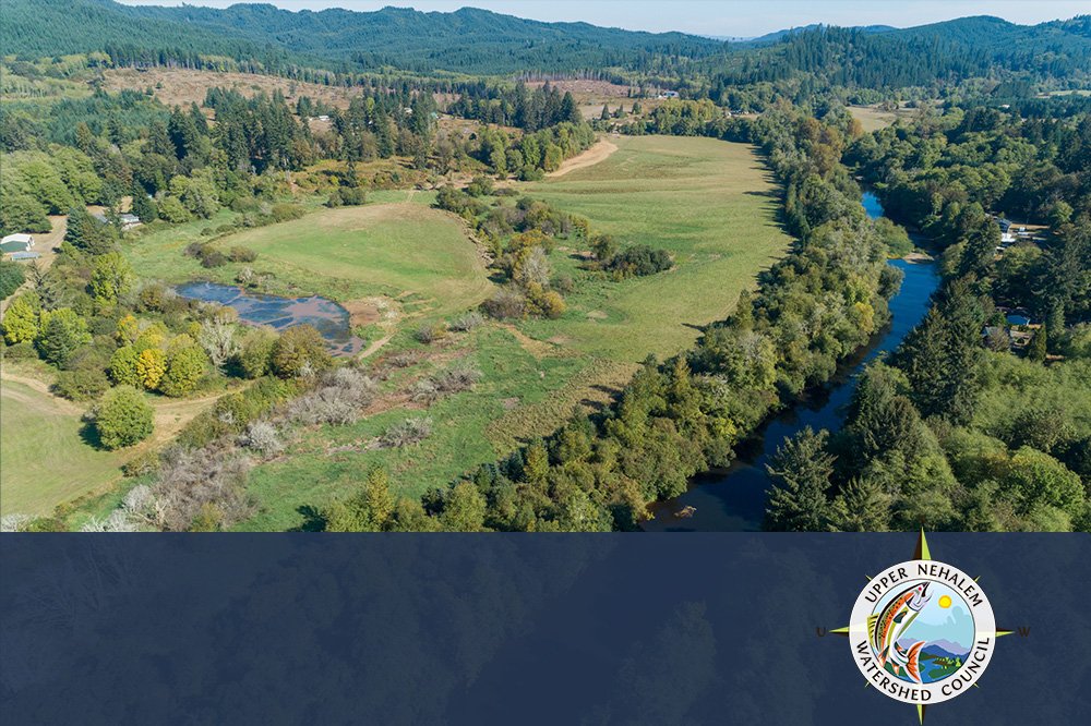
In 2022, ForeSight Drone Services collaborated with the Upper Nehalem Watershed Council and partners to monitor and document the Tweedle Creek channel and wetland restoration project. The goals of the project were to increase the availability of low velocity off channel winter and cool summer refuge for Coast Coho and lamprey by addressing habitat limiting factors. ForeSight contributed aerial imagery for effectiveness monitoring, and stakeholder engagement.
Results
Quantitative effectiveness monitoring, achieved through repeat aerial mapping, provided valuable data and satisfied grant requirements for floodplain habitat, LWD presence, wetland expansion and beaver presence/absence monitoring. The qualitative monitoring and communication enhancement through aerial photo-points facilitated documentation of key project impacts and enhanced stakeholder engagement, even those at a distance.
Services
Client
2022
Project Date


Before and After


Repeat Aerial Mapping missions captured before and after conditions in high-resolution orthomosaics for change detection and impact assessment.
FEATURED CASE STUDY