
Featured Project
Coast Range Forestry Landslide Impact Assessment
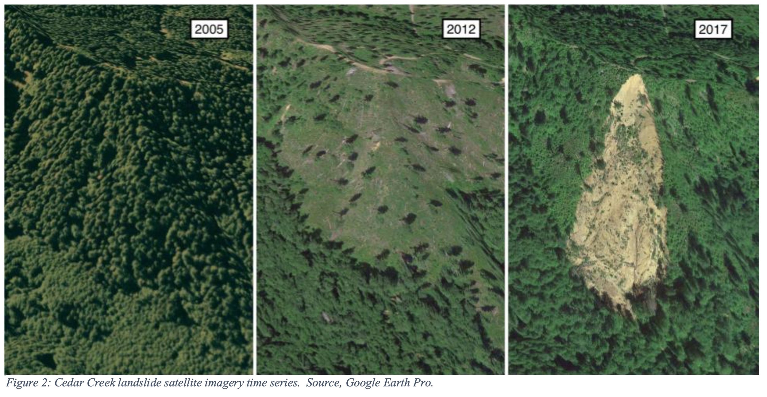
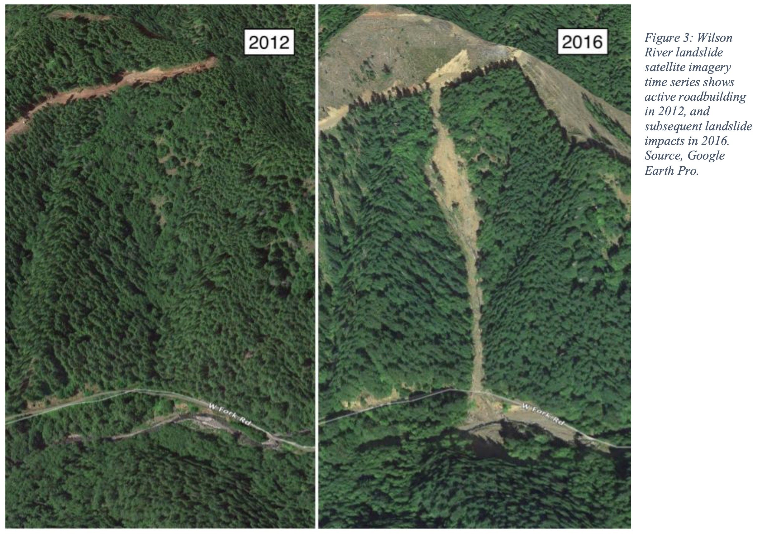
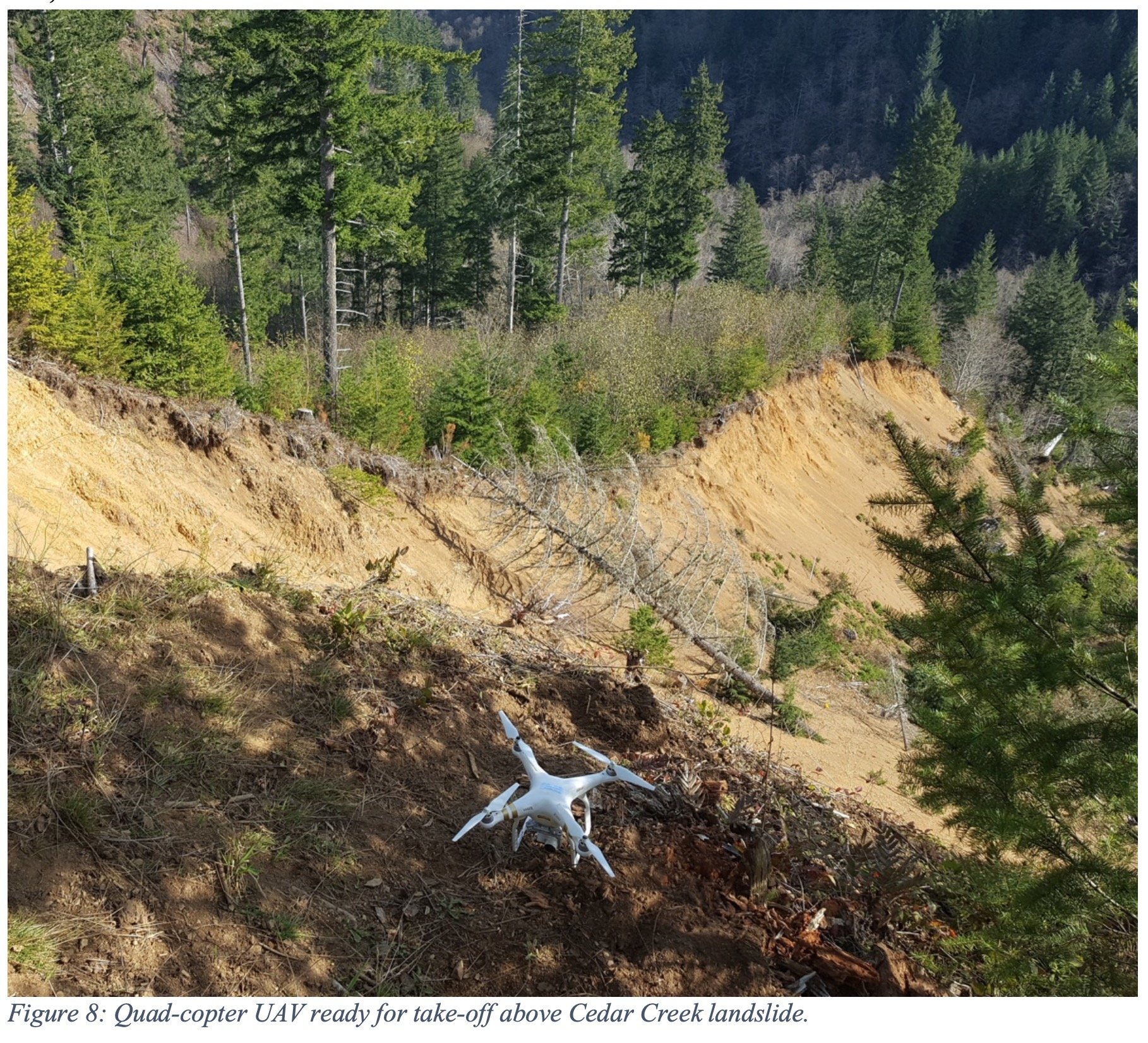
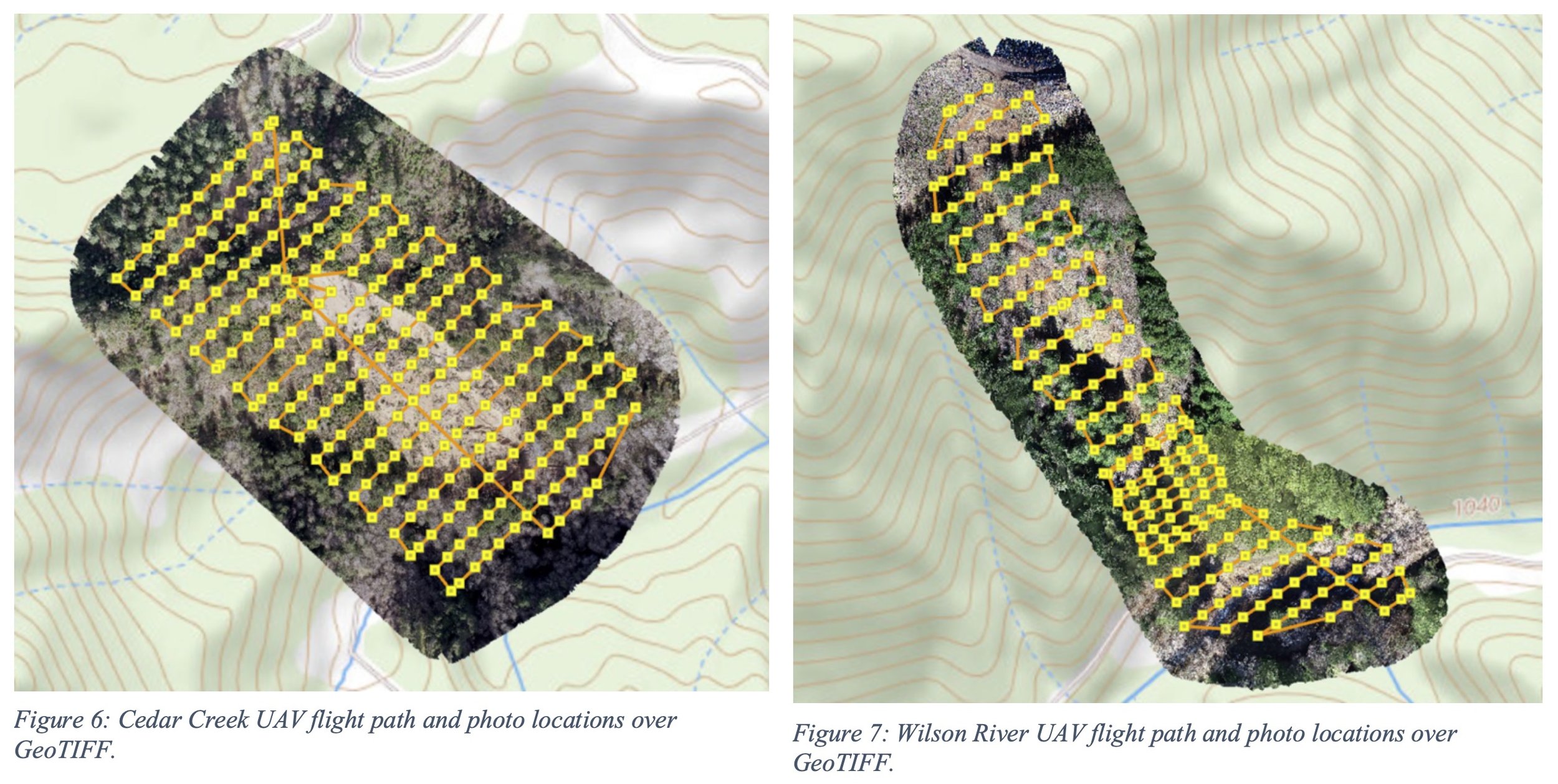
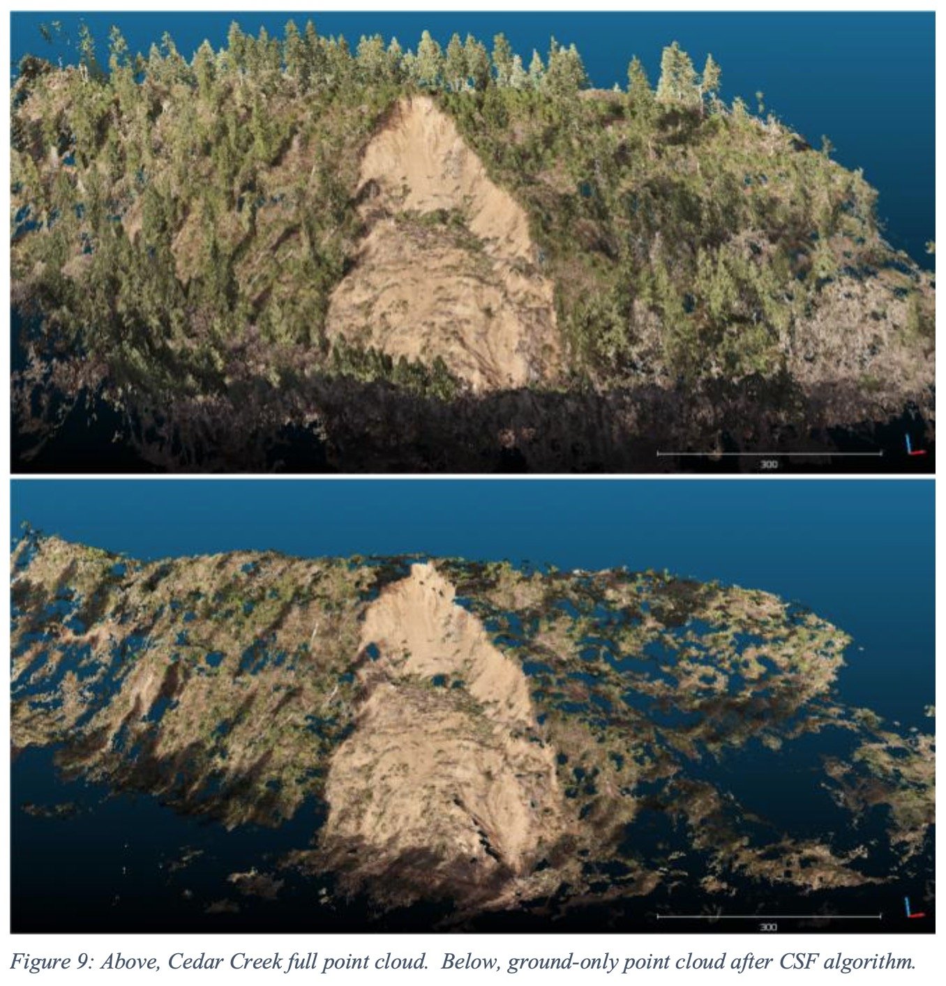
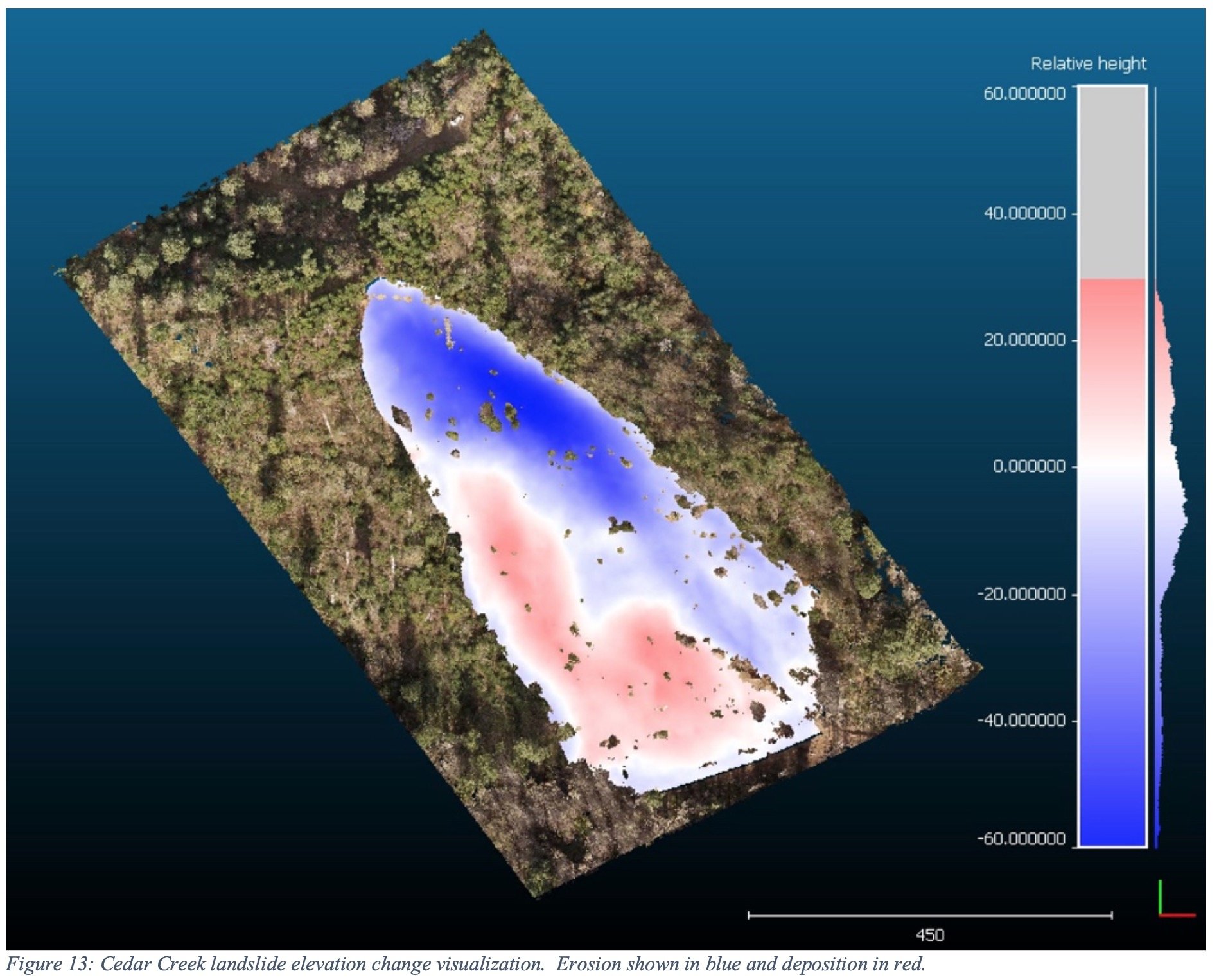
ForeSight collaborated with the Native Fish Society to quantify the impacts of two forestry-related landslides on threatened Coast Coho salmon. To support an on-going litigation, we utilized drones, publicly available LiDAR data, and open-source analysis tools, to measure erosion and deposition impacts on fish-bearing streams where fine sediments can smother coho spawning and rearing habitat.
Results
Measurements of 2-dimensional extent, and 3-dimensional erosion and deposition volumes told a powerful story about the impact of forestry-related landslides to native fish-bearing streams. A legal settlement produced new protections for threatened salmon in Oregon’s Tillamook and Clatsop State Forests by increasing no-cut riparian buffers on fish-bearing streams and new buffers for upland sites on steep slopes that are prone to landslides.
Services
Client
2019
Project Date


Video Feature

An interview with ForeSight founder, Nick Wagner, about quantifying erosion and deposition of forestry related landslides and the impacts to threatened Coast Coho salmon in the Oregon coast range.
“NFS is really grateful to have Nick collaborating with us and lending his skills to our conservation work in the Oregon Coast Range.”
Jennifer Fairbrother, Conservation Director, Native Fish Society
FEATURED CASE STUDY